July 21, 2015
A blog entry by CKS about bicycling going paperless reminded me to blog that I joined the revolution. It happened in Akron, Ohio, on the way home.

Normally I would follow The Big Cicrle, which bends northwards in CONUS, and I prepared for a route along it. However, on that day, a chain of weather systems queued up all the way from Seattle to Pittsburgh. Akron itself was barely VFR. I took a smart decision to deviate far to the south, into Kentucky. The only problem: since I did not expect a deviation of such magnitude, I did not have the required charts.
Normally, a pilot in such situation simply buys the needed charts. I went to the FBO, and the cute clerk girl informed me that they did not sell charts anymore. You see, Akron is a high class field, and jet jockeys all use iPads nowadays, so it was pointless to stock the charts. But a flight school subleased the building, and they had charts for sale, for use by students. I went there, and found that they only had the local chart, which was sufficient for students.
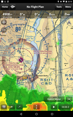
At that moment I understood that the resistance was futile. I whipped out my Nexus 7 and downloaded Garmin Pilot. It was $75 for 1 year, or much cheaper than staying in Akron for a week (or killing myself by taking risks with the storms). I sketched myself a bit of a backup in case of trouble with Nexus, then went south and dodged clouds a little bit. I overnighted in Arkansas, then flew home in 1 day in perfect weather.
I still don't have a smartphone though.
Posted by: Pete Zaitcev at
08:35 PM
| No Comments
| Add Comment
Post contains 281 words, total size 2 kb.
23 queries taking 0.0277 seconds, 27 records returned.
Powered by Minx 1.1.6c-pink.


